

The Larapinta Trail had remained a question mark as we made our way through outback Queensland and across the Northern Territory border. Lockdowns and border restrictions delayed our departure date, messing with our timeline so that we weren’t really sure of when we would be where. By the time we made it to Central Australia, things were starting to heat up. While a select few were still starting the Larapinta Trail at the end of September, the general consensus was to hold off and come back during the cooler season. Determined not to miss out completely, we set out on a camping trip through the West Macdonnell Ranges (Tjoritja), experiencing the unrefined beauty of the Red Centre Way, and getting a taste of the Larapinta.
Day 1
The road between Alice Springs (the starting point) to Red Bank (finish point) is only 156 km long, with around 10-11 major sights along the way. This meant picking what to do when was really up to us, as going between stops and potentially doubling back was relatively easy.
Starting from Alice Springs, we traveled west, along Larapinta Drive. The first stop was Simpsons Gap (Rungutjirpa), the starting point for Section 2 of the Larapinta Trail. It’s only a short walk into the waterhole, with the early morning sun igniting the towering red-rock hills on either side.
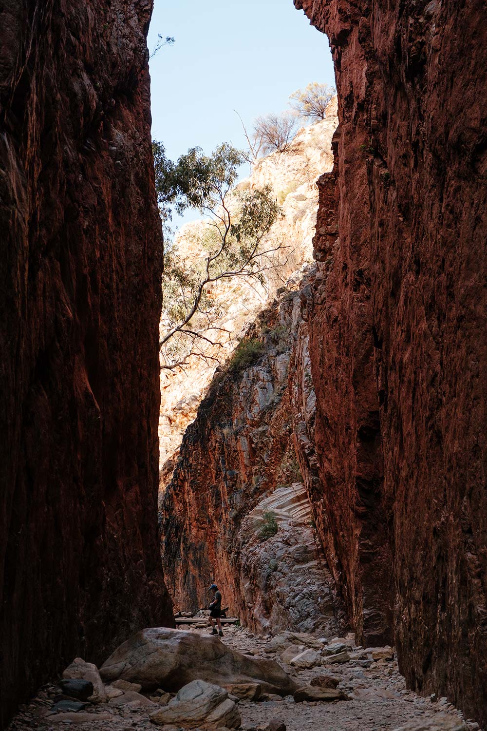
The next stop was Standley Chasm (Angkerle Atwatye), which involved a quick 2.4 km return trail, brimming with birdlife and botanic marvels. The endpoint is a slender corridor that cuts through the 80m-high crimson rock walls. This is the only stop with an entry fee ($12), to assist the traditional owners to maintain the area.
We reached Ellery Creek Big Hole (Udepata) around 10am. This iconic waterhole marks the trailhead for Sections 6 and 7 of the Larapinta. While the waterhole can be accessed directly from the carpark, we decided to do the 3km Dolomite Walk — a circuit which stretched out along the exposed hillsides, spinifex clawing out our ankles. It was interesting to see the direct contrast between the red quartzite peaks and the browns and greys of the dolomite hills. The walk also helped heat things up, making it much easier to take a quick dip in the icy waterhole.
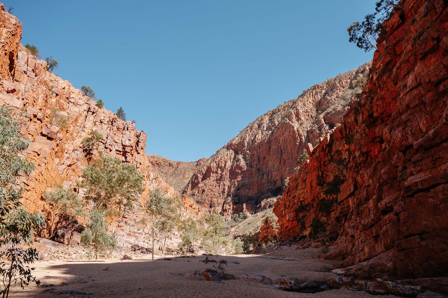
While it was certainly getting warmer, we pressed on to Serpentine Gorge (Ulpma). Marking the trailhead for Sections 7 and 8, this was a quick 1.1km walk into a rather dried-out waterhole. It’s still a great spot to check out the frenzied flights of budgereegas and zebra finches that swoop in and out across the stagnant water. There is also a turn-off to a lookout, just before the waterhole. This quick 15-minute ascent took us to a viewing platform overlooking the red peaks and barren valley that surrounds the gorge.
The Ochre Pits, the final stop of the day, only required a quick 300m walk to the site. A place of cultural significance to the Aranda people, these pits contain vivid purple, yellow, red, and white walls of ochre, which was used in traditional ceremonies and traded among Indigenous tribes.
Campsite
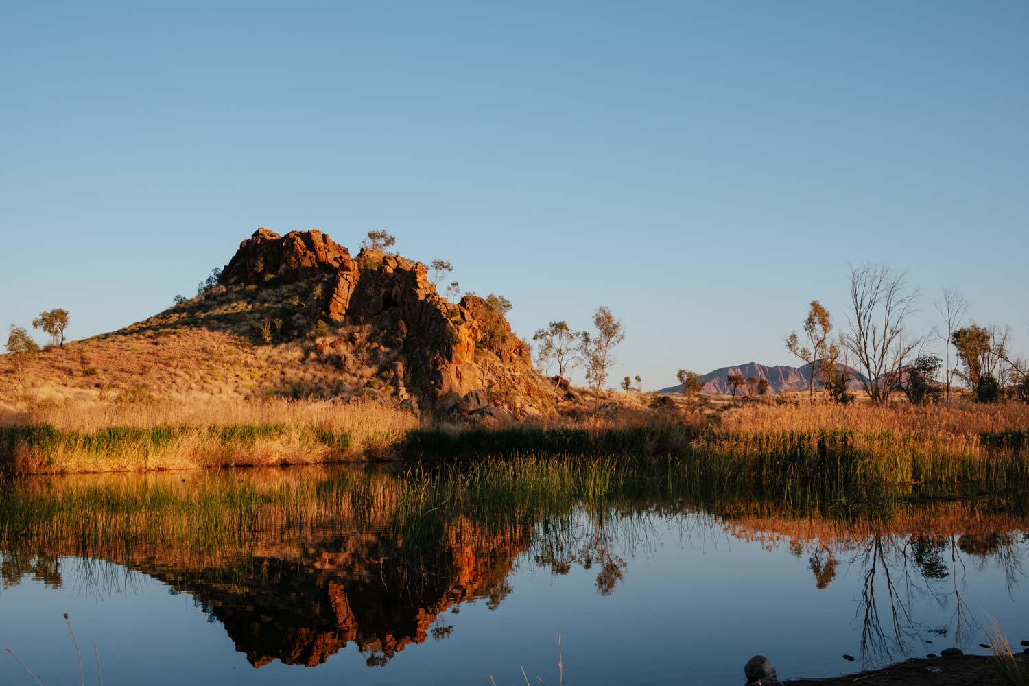
After being on the road for nearly three months, the Finke 2 Mile still remains our favourite free-camp spot. Situated across the road from the Glen Helen (Yapalpe) resort turn off, this campground is only accessible by 4WD (although we did see one 2WD van tear through the sandy track, give us a quick ‘shakas’, and drive off into the sunset). While the track is relatively easy to navigate, the sand can get quite built up in certain spots (we saw one car get bogged pulling into the camp). The campground sits right on the edge of the Finke River and the opposite banks offer stunning views of distant red-rock mounds poking through fields of yellow grass, which light up in the early afternoon and morning sun. This is a free camp, so a shower meant taking a quick dip in the reed-filled river to wash off everything we picked up throughout the day.
Day 2
We rose with the sun, brewing a quick coffee on our Jetboil (a great timesaver when in need of a warm drink or a quick meal) while watching the birds stretch their wings on the river banks.
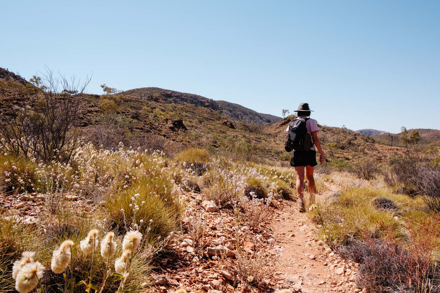
The first stop on Day 2 was the Ormiston Gorge (Kwartatuma) Pound Walk. The starting point is the Ormiston Gorge Carpark, a ten-minute drive back along the same road we traveled yesterday. This 9km circuit walk, which marks the trailhead for Sections 9 and 10 of the Larapinta, took us roughly 3-4 hours. The walk offered panoramic views of the valley before making our way into the gorge. This part of the walk was particularly enjoyable, surrounded by the vast gorge walls, as well as the rugged plant life and small, withering waterholes.
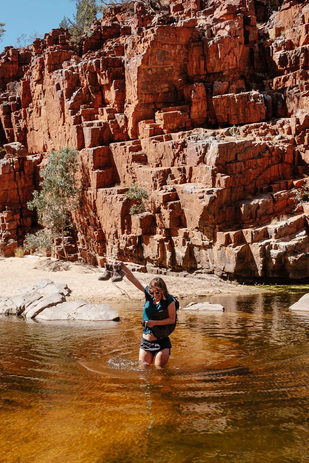
The walk also required us to cross a small stretch of water, which still reached our stomach at the deepest point at the end of the dry season. After the crossing there is a fork in the road, with the option to continue along the sandy valley floor towards the car park, or trek upwards, finishing the walk by going back through the Ghost Gum Lookout Walk (a quicker, 40 minute walk to a lookout platform). We chose the latter, although the views weren’t nearly as impressive as what we had seen so far.
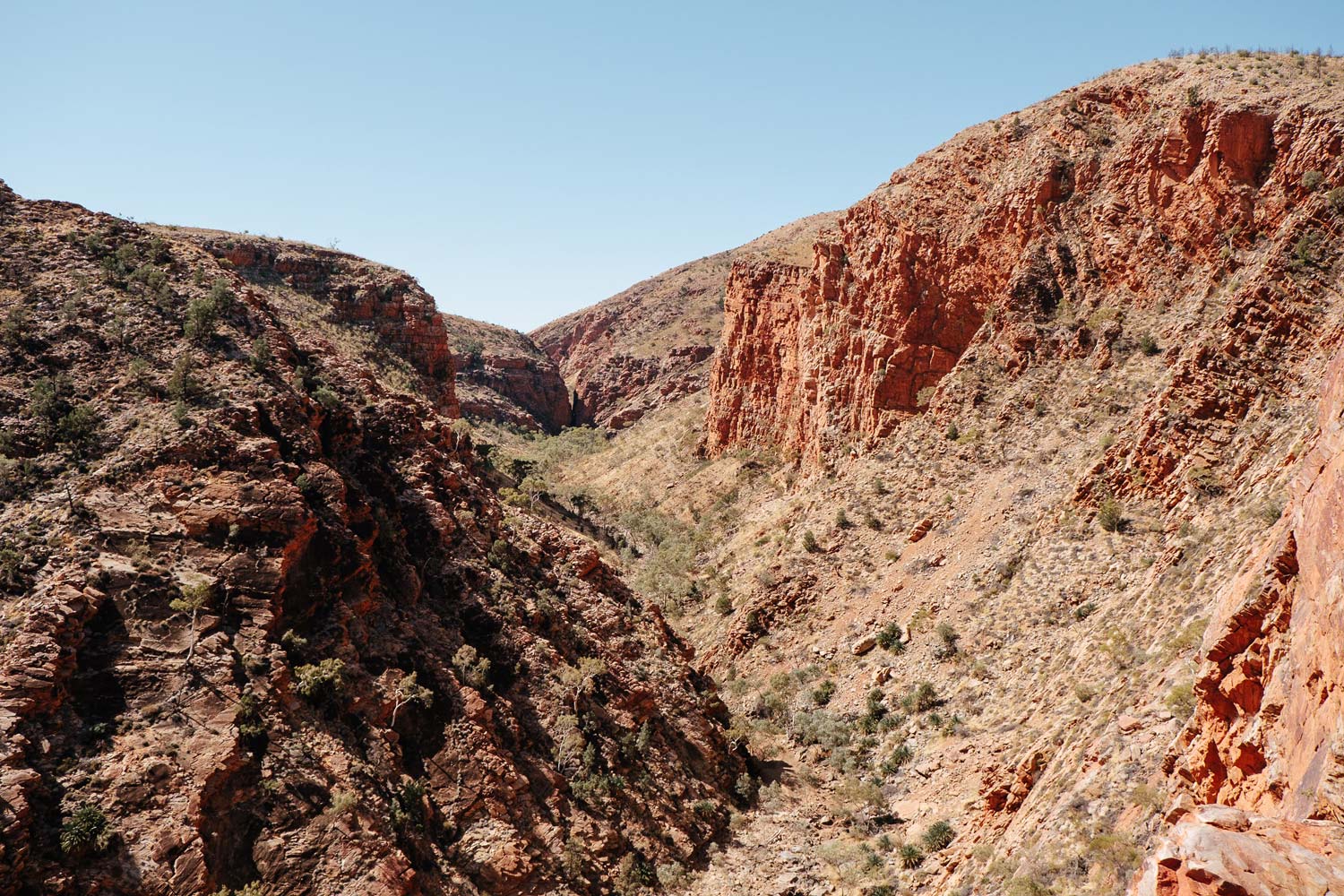
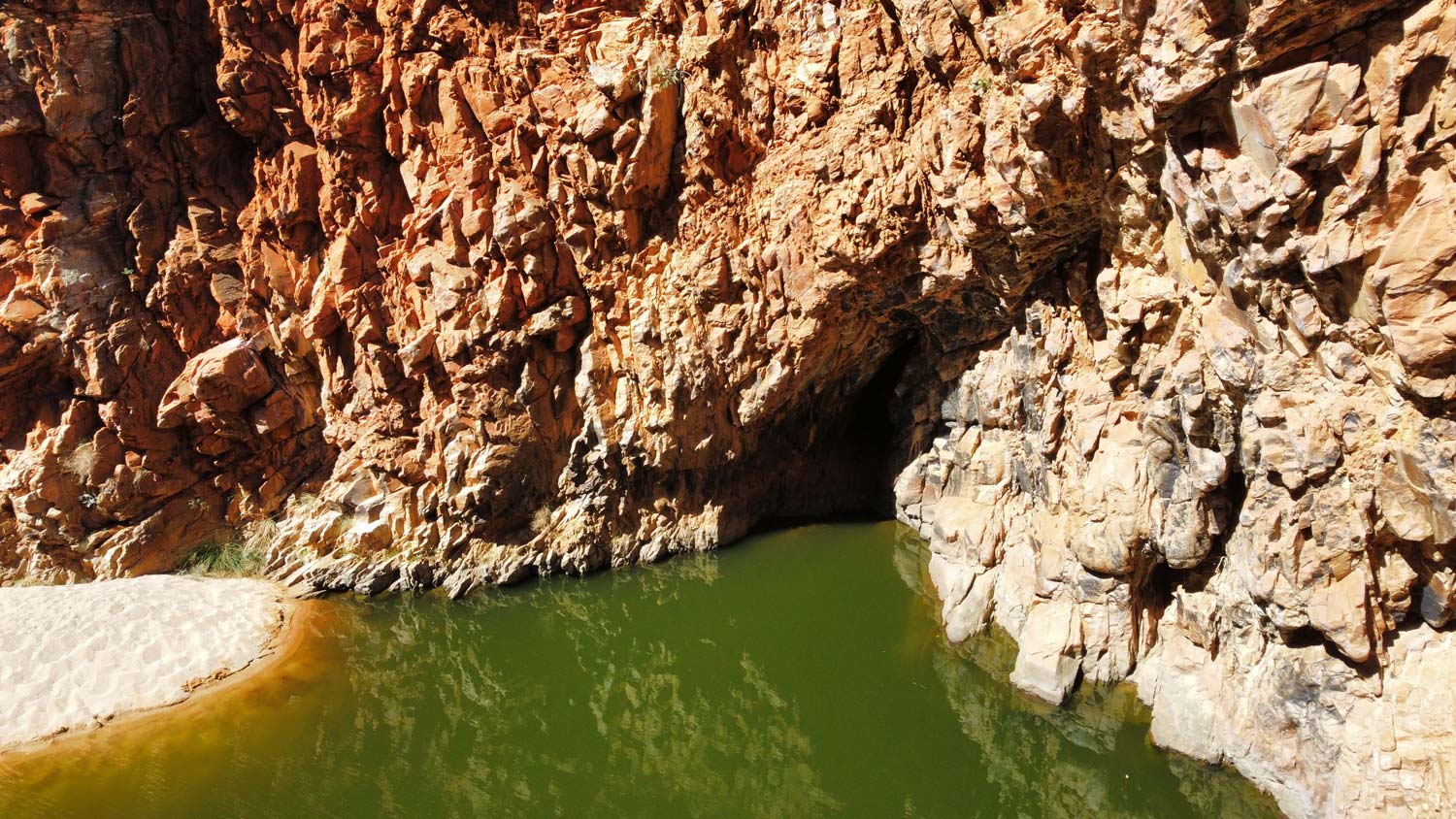
While the Pound Walk was easily our highlight of the West Macdonnell Ranges, we were keen to cool off after reaching the car park. We made our way to Red Bank Gorge (Yarretyeke), another 30 minute drive that actually goes past the final stop of the day, Glen Helen. Red Bank Gorge also marks the end of the Larapinta Trail (or the start for those travelling east towards Alice). It’s only a short, but rather rocky walk into the Gorge. We were a bit disappointed in this popular spot, as the water was rather stagnant and uninviting at this time of year. The contrast between the bright red, jagged rocks and green water still made for some great photos.
We eventually got our swim at Glen Helen (the trailhead for Section 10 of the Larapinta). A quick, unmarked walk through the tall grass led us to where the range parts for the dark, icy waters of the Finke River.
We turned in for the night at Finke 2 Mile, having loved it so much the first night. In hindsight we really should have camped at Redbank Gorge, in preparation for tomorrow's very eary start.
Day 3
The third day in the West Macdonnell Ranges was marked by a 2:00am start, with the plan to summit Mount Sonder (Rwetyepme) in time for sunrise. The hike starts at the same Redbank Gorge carpark we had been the previous day.
Summiting Mount Sonder is also the final hurdle for many of the Larapinta Trail hikers, which entails a 16km return journey (taking around 8 hours to complete) to the highest peak in the West Macs. The majority of the push towards the summit was uphill, and involved a bit of stumbling in the dark (we recommend a good head torch if attempting the night ascent). Once we reached the summit, we sat back to enjoy the sunrise. It was great to watch the light unfold across the valleys and neighbouring peaks.
Mount Sonder not only marks the end of the Larapinta Trail, but also our own journey through the West Macs. From here, we continued on our road trip towards Palm Valley, and then on to the iconic Watarrka National Park. It’s also just under a 2-hour drive back to Alice Springs, which we found to be a strange concept considering how much we had seen on this small stretch of road.
FAQs
Larapinta Drive is completely sealed. However, the turn-offs into many of the gorges are mainly gravel, with some more rugged than others. All should be manageable in a 2WD, but this largely depends on the capability of your car.
Don’t despair if you aren’t traveling in a 4WD and can’t access Finke 2 Mile (although we do recommend one) - there are plenty of spots to camp along the way. There were campsites at Standley Chasm, Ellery Creek Big Hole, Ormiston Gorge, Glen Helen, and Redbank Gorge, as well as other free camps scattered along the road. Remember to check ahead and make sure the ones you plan to stay at are still open (Glen Helen Resort, for example, was closed, which actually left some fellow travellers without enough petrol to make it all the way back to Alice.)
The difficulty of these walks vary significantly. Smaller walks, like the ones into Ellery Creek Big Hole, the Ochre Pits, Serpentine Gorge, etc. are all quick, easy dirt tracks. We would recommend a higher level of fitness for the Ormiston Gorge Pound Walk and Mount Sonder Summit.
No permit is required to drive and walk through the West Macdonnell Ranges. There is an entry fee into Standley Chasm, which can be purchased on site.
We traveled during the change of season, with nights spent rugged up in tracksuits and jumpers, and days spent in a light walking shirt and shorts. However, most of the time we both kept on our Craghoppers shirts, as it was great against the cold of the early mornings, and kept us covered in the midday sun.