

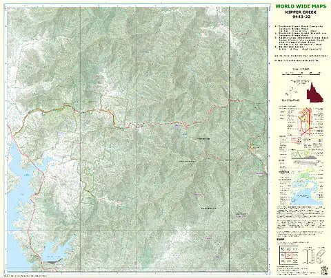
Description
The standard topo map has been enhanced by World Wide Maps with 4 bush walks highlighted.
1. England Creek Bush Camp via Joyners Ridge Road
2. England Creek (right branch) via Joyners Ridge Road
3. Aquila Loop (England Creek Bush Camp Circuit)
4. Northbrook Gorge
The map covers part of South D’aguilar National Park, Brisbane Forest Park.
Contact us within 30 days of receiving your goods to request a refund or exchange if products are eligible (see: Return Policy).
All packaging or products must be in their original, re-sellable condition.
Outlet sales are final and can only be returned for exchange. Items found faulty or under warranty will be replaced or refunded.
Some special condition products are labelled as No Refund & Exchange Products. Sale of these items are final and are not eligible for neither refunds nor exchanges.
For safety reasons, K2 cannot accept returns on climbing equipment, socks, underwear and some other products unless faulty.
Please check out our refund policy if you need more information.